
A pilot project involving CONABIO, the Mexican Climate Initiative, and HOT explores the use of MapSwipe to identify natural land cover, showcasing its potential for citizen science and participatory environmental monitoring.
Spanish version
Mangroves and Native Forests: Ecosystems at Risk
Mangrove and native forest ecosystems in Latin America face increasing pressure due to the expansion of agricultural frontiers, uncontrolled urbanization, tourism development, and the effects of climate change. In Mexico, this situation is especially critical: the country holds over 5% of the world’s mangroves, but has lost thousands of hectares in recent decades.
These ecosystems are not only vital for biodiversity, but they also serve as natural barriers against storms, help mitigate flood impacts, and absorb large amounts of carbon. Their protection and monitoring are urgent, yet data is often insufficient or outdated.
Moreover, these mangrove and forest areas can span vast territories, which presents a challenge for environmental authorities and even more so for civil society organizations seeking to raise awareness about the degradation of these essential ecosystems and the environmental services they provide.
In response to this need, accessible tools like MapSwipe represent an opportunity to strengthen collective knowledge and promote citizen participation in their defense. MapSwipe is a technology specialized in the visual observation of large areas, allowing a broad community of users to examine satellite images from their mobile phones or computers and quickly identify features based on simple instructions—no specialized cartographic skills required.
In the following video, colleagues from Doctors Without Borders demonstrate how to use it in a straightforward way:
MapSwipe: Participatory Technology Against Ecosystem Loss
MapSwipe is a web and mobile application that enables volunteers around the world to contribute to humanitarian mapping quickly and easily. Through the app and website, users with no background in cartography review satellite imagery and mark areas with the presence of roads, buildings, or settlements—helping prioritize zones that need more detailed mapping. This information is key for humanitarian organizations as it allows them to focus their efforts on the most vulnerable areas and improve responses to natural disasters, health crises, or development projects. It’s an easy and accessible way to contribute to global mapping without any prior experience.
A pilot project using the MapSwipe tool was designed to broaden its reach beyond traditional uses. Until now, the application has primarily been used to identify buildings and infrastructure in specific areas or to validate elements previously mapped in the OpenStreetMap (OSM) database. However, this new project aims to innovate by generating thematic maps based on the identification of different types of land cover.
The project’s approach allows people with basic knowledge to identify land cover types, removing the need for specialized professionals in cartography, forestry, agriculture, or geographic information systems. “One of MapSwipe’s greatest strengths is its community: the fact that many non-specialists can engage in these activities,” highlights Juan Melo, Senior Associate for Data Quality at the Latin America and Caribbean Hub (LAC Hub).
The idea is that any user, able to distinguish between two basic types of land cover in a specific area (for example, differentiating between natural and urban areas), can contribute to the creation of this kind of map.
Collaboration with CONABIO
The collaboration between HOT and the National Commission for the Knowledge and Use of Biodiversity (CONABIO) emerged from an interest in exploring how crowdsourcing can support forest monitoring in Latin America.
CONABIO’s Geomatics Department, responsible for monitoring systems such as forest fire detection and citizen science platforms like Naturalista and AVerAves, agreed to explore partnerships focused on detecting forest loss and deforestation—especially through participatory tools like MapSwipe.
Throughout 2023, a working group was formed including CONABIO, HOT, HeiGIT (Heidelberg Institute for Geoinformation Technology), and the American Red Cross. The group discussed how to adapt MapSwipe for participatory environmental monitoring, initially focusing on mangroves in Quintana Roo, with pilot tests in municipalities such as Tulum and Benito Juárez.
Over several months, technical sessions were held to define potential MapSwipe workflows and identify challenges. CONABIO teams—especially Isabel Cruz, Luis Valderrama, and Ernesto Rodríguez—reviewed the system and provided detailed feedback on user experience, image relevance, the need for spatial references, and suggestions for the ideal profile of mappers (preferably with experience in photo interpretation).
It was recognized that MapSwipe is a lightweight tool, focused on binary visual validation (yes/no), which limits the inclusion of certain geographic elements or metadata (such as precise dates or political boundaries). Despite this, the tool was valued for its potential as a complement to existing systems and as a bridge to engage users with mid-level technical knowledge in mangrove change validation.
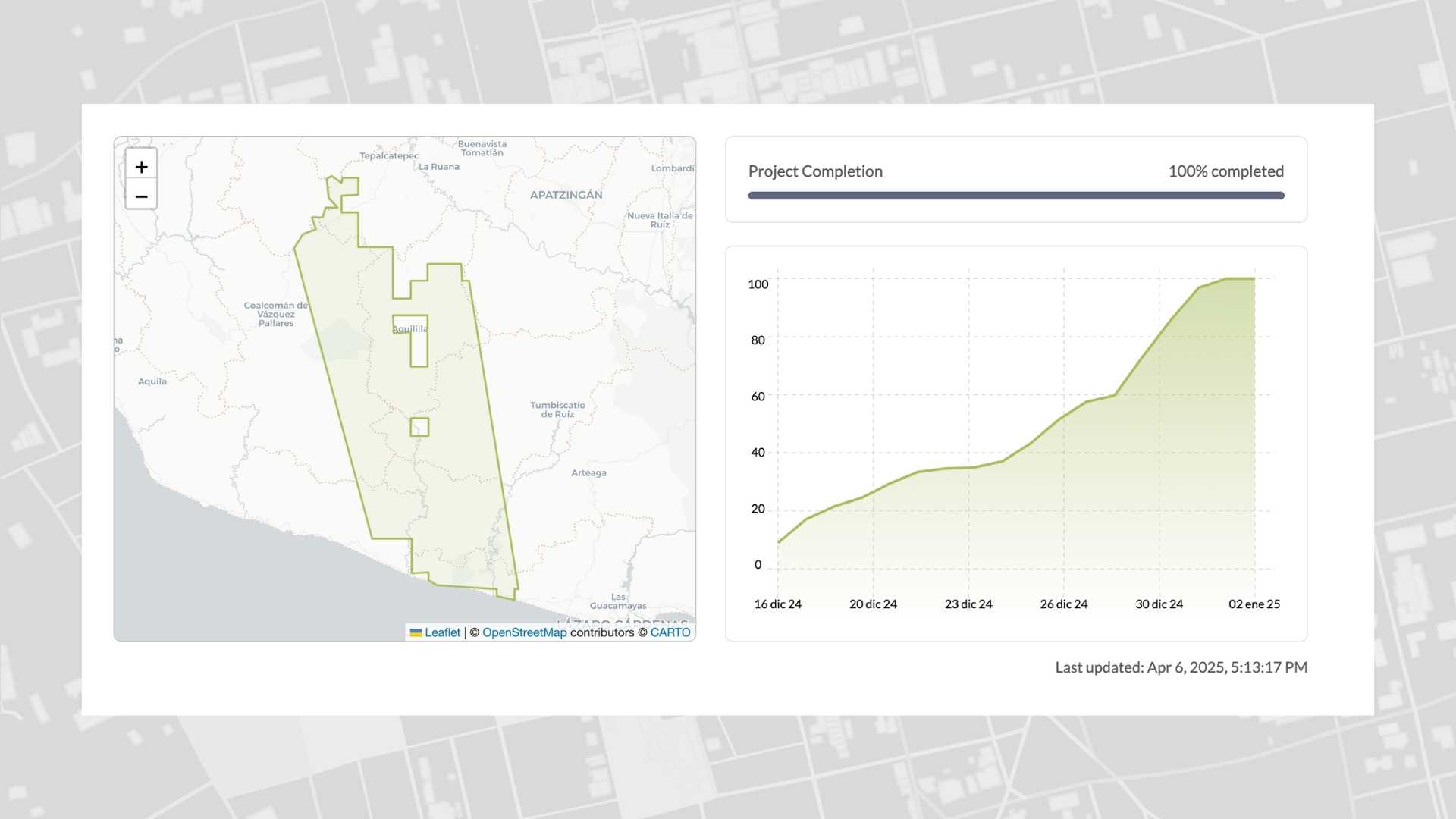
In October 2024, a participatory mapping pilot was finally launched with a call led by CONABIO to test MapSwipe with 15 to 30 volunteers. A kickoff meeting was held on October 22, where the tool, project goals, and next steps were explained. The trial lasted two weeks, during which participants were asked to visually identify changes in mangrove cover using satellite images.
The initiative is the result of over a year of collaborative inter-institutional work, involving technical dialogue, adaptation of existing tools, and the joint definition of a model that tests the value of digital citizen science for environmental monitoring—particularly in complex ecosystems like mangroves.
As part of a joint effort to explore new forms of citizen participation in geospatial data generation, CONABIO and HOT developed an innovative pilot throughout 2023 and 2024 using the MapSwipe4Web application to observe changes in mangrove cover along the coast of Quintana Roo.
This project aims to assess the long-term viability of the institution using this tool to identify land cover through satellite imagery—paving the way for future scientific and community applications. The goal is to obtain faster results that can inform environmental decision-making in the country.
Collaboration with the Mexico Climate Initiative
The relationship between HOT and the Mexico Climate Initiative (ICM) began with a proposal from HOT to explore possible collaborations on forest monitoring with a civil society expert organization like ICM. Through its Net Zero Deforestation Observatory, ICM promotes transparency and disseminates information on the impacts of development projects on forest cover in Mexico, while also facilitating reporting to official platforms (such as denuncias@profepa.gob.mx).
Generating useful information for environmental monitoring and influencing public policy was a shared interest. HOT proposed integrating citizen participation into these monitoring efforts, potentially making them faster and broader in reach, while also enabling the analysis of historical satellite imagery to create a record of forest degradation.
The forest monitoring methodology with ICM was quickly defined through a structured approach based on areas generated from points provided by the National Forestry Commission (CONAFOR). The process moved from individual area analysis to a quadrant-based system, with monitoring points acting as centroids and sides measuring between 10 and 15 meters. This decision enabled temporal comparisons of forest cover.
The next challenge was to find reliable satellite images with sufficient resolution from freely available sources, which presented the difficulty of not being able to define specific acquisition dates and, therefore, precise monitoring periods.
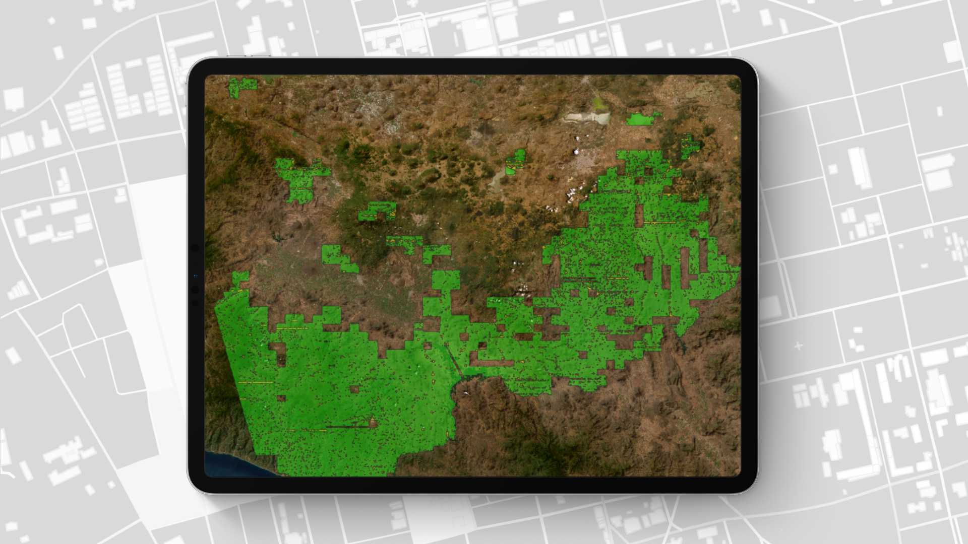
The first observations focused on key municipalities such as Carmen, Palizada, and Campeche, which represent different types of forest ecosystems. In parallel, a separate experiment was conducted in the forests of Michoacán using MapSwipe, where volunteers identified cover types as either “natural (forest)” or “artificial (urban, pastures, crops, etc.)” using only current images. This promising experiment also posed challenges, especially in transition zones between forested and urban areas.
Context and Current Challenges
The creation of thematic cartography presents several challenges, as it is traditionally carried out using two main methodologies:
-
Visual interpretation: Requires highly trained professionals in cartography capable of delineating land cover using complex visual criteria.
-
Digital classifications: Relies on automated algorithms to classify land cover based on digital image values. However, this method has limitations because different land covers may share similar spectral responses, or a single land cover may exhibit spectral variability.
This MapSwipe pilot seeks to overcome those limitations by developing an accessible system for non-technical users. If thematic cartography creation can be decoupled from exclusive reliance on highly specialized professionals, new possibilities will open for more inclusive and accessible map generation.
Project Innovation
As part of the pilot project developed in collaboration with a climate initiative, technical design and conceptualization were carried out with the support of the Humanitarian OpenStreetMap Team (HOT). The implementation took place in a specific region: Michoacán, located in southwestern Mexico. This territory was selected as a sampling area to carry out the identification of two types of land cover:
-
Natural areas: including forested surfaces in various states of conservation (primary, secondary, or tertiary).
-
Intervened areas: including agricultural, livestock, industrial, mining, and urban zones.
Participants were asked to use the MapSwipe tool to make a basic classification. Depending on whether they observed natural or artificial/intervened areas in the images, participants were to perform a specific number of “taps” on their screens.
“This analysis is very well structured and gives us several clues for the future. The exercise helps us think about how we can socialize and involve the community and the general public in these kinds of exercises,” said José Morales, Ecosystems and Climate Change Manager at the Mexico Climate Initiative.
Results
The results of the pilot project offer an encouraging outlook on the potential to involve non-technical people in thematic cartography creation. Specifically, the project identified inherent challenges in differentiating between natural and artificial areas—valuable lessons to improve methodology in future initiatives.
“What we’re doing with the support of CONABIO and the Mexico Climate Initiative is truly valuable, because MapSwipe had never been used for more than simply marking: ‘there’s a building here.’ And this goes beyond that,” shares Juan Melo, Data Quality Specialist at the LAC Hub.
MapSwipe results identifying land cover in Michoacán can be explored in full at this link.
One of the main findings was the difficulty participants faced in distinguishing certain covers, such as grasses or tree crops, from natural areas like secondary or tertiary forests.
Despite these challenges, the pilot demonstrated the great potential of this methodology to democratize thematic cartography. With a simple and accessible approach, it was possible to mobilize a community of enthusiastic users who managed to cover large areas in a relatively short time. This model stands out for its low cost, rapid deployment potential, and the ability to be replicated by communities or organizations that lack the human or technological resources to produce technical maps.
Moreover, the process of transforming the data collected in MapSwipe into a thematic map is efficient and technologically accessible. This highlights the feasibility of scaling such initiatives, allowing a wide range of stakeholders—often limited in technical capacities—to actively contribute to the generation of relevant cartographic data for decision-making.
In summary, this pilot project not only identified areas for improvement in technical precision but also validated MapSwipe’s potential as a powerful tool to empower communities and promote collaboration in the inclusive and efficient creation of thematic maps.
Are you part of an organization with similar goals and expertise in forest preservation? Do you face limitations when monitoring large areas? Get in touch to share your perspective at hublac@hotosm.org!
from Humanitarian activities – Techyrack Hub https://ift.tt/IBetlc4
via IFTTT


