In Belém, geotech activists exchanged experiences to address issues such as the climate crisis. Since open data and cartography are essential in the search for popular sovereignty in the territories, how can they serve the Amazonian peoples?
The following post about SOTM LATAM 2024 was written by Antonio Laranjeira* and originally published in Portuguese on the website Outras Palavras. We publish -slightly edited- the Spanish translation of said post with the due authorization of the author.
Belém do Pará is in the center of world attention. In 2025, the city will host COP-30, a conference that will bring together world leaders to discuss urgent climate solutions. A year earlier, Belém hosted another global event: the State of the Map Latam (SOTM).
The conference brought together cartographers, governments and businesses interested in geospatial data and its applications for citizens, with a free programme of talks and workshops taking place on 6, 7 and 8 December.
Geospatial data is information linked to geographic location, such as interactive maps, satellite images and digital terrain models. This data plays a fundamental role in the organization of public space, environmental monitoring and decision-making.
While the Google Maps platform popularized maps, it was OpenStreetMap that popularized cartography on the global web. Examples demonstrate that, when accessible and collaborative, open maps become powerful data resources to promote transparency, sovereignty and justice.
The open mapping movement was born in 2004 with the creation of the OpenStreetMap platform, and has since transformed the way we see the world. In contrast to the monopoly of platforms such as Google Maps, OpenStreetMap offers a decentralized and accessible alternative that reflects local realities and respects territorial diversity.
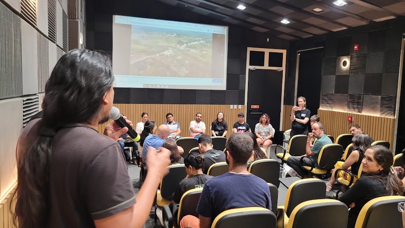
In the Amazon, this approach is particularly relevant. Being on the map means belonging, exercising autonomy and asserting sovereignty over the lived territory. Visibilities and territorialities are at stake in a region often ignored or distorted by hegemonic cartographies.
Communities of hackers and makers such as the Open Mapping Hub and Youth Mappers involve people of different ages, genders and social classes in a common cause: overcoming the challenge of obtaining geospatial data made by many hands, maps that represent everyone, not only the territories, but also their uses and actions that give cultural, political and economic meaning to these places.
Stories we met in Belém
In total, SOTM Latam 2024 had participants from 18 countries present in Belém do Pará, as shown in the map below.
The program included workshops and conferences, conversations and meetings. The topics covered in SOTM can be summarized in three axes: stories of social impact in the Amazon, stories of open technologies and stories of public space management.
Below is a summary of insights into the most impactful things seen and heard during the conference. All reports have the representatives’ contact details and profiles available on the global event website.
Stories of social impact in the Amazon
The Meninas da Geo project, which since 2019 has encouraged young women to strengthen their knowledge in geotechnology, was represented by Tatiana Pará. Among other techniques, the group learns geoprocessing and programming with free software. The application of knowledge is a priority in the rural area of the state of Pará, especially by uniting the demands of the subject of exact and earth sciences, of connecting the territories crossed to the social strengthening of women as producers of science, technology and food. Other members of the group were also presented, including young and adult women who have already completed their participation in the project and are now agents of inclusion of other people in the OpenStreetMap community.
Johnattan Rupire presented the experience of the Collaborative Socio-Environmental Cartography Course in the Peruvian Amazon, an initiative that trained 31 people for collaborative mapping, including indigenous leaders, students and representatives of civil society organizations (see photo below). The training, carried out in Yarinacocha, sought to prepare communities to monitor and protect their territories against threats such as deforestation and forest fires.. Despite challenges such as inequality in access to resources and technology, the course achieved significant results such as the creation of a local network of indigenous cartographers; the implementation of a pilot cartography curriculum in local schools; the establishment of partnerships for mapping projects in remote territories. An assumption that cartographic data in OpenStreetMap can become an asset for the defense and empowerment of the territorial sovereignty of indigenous peoples.
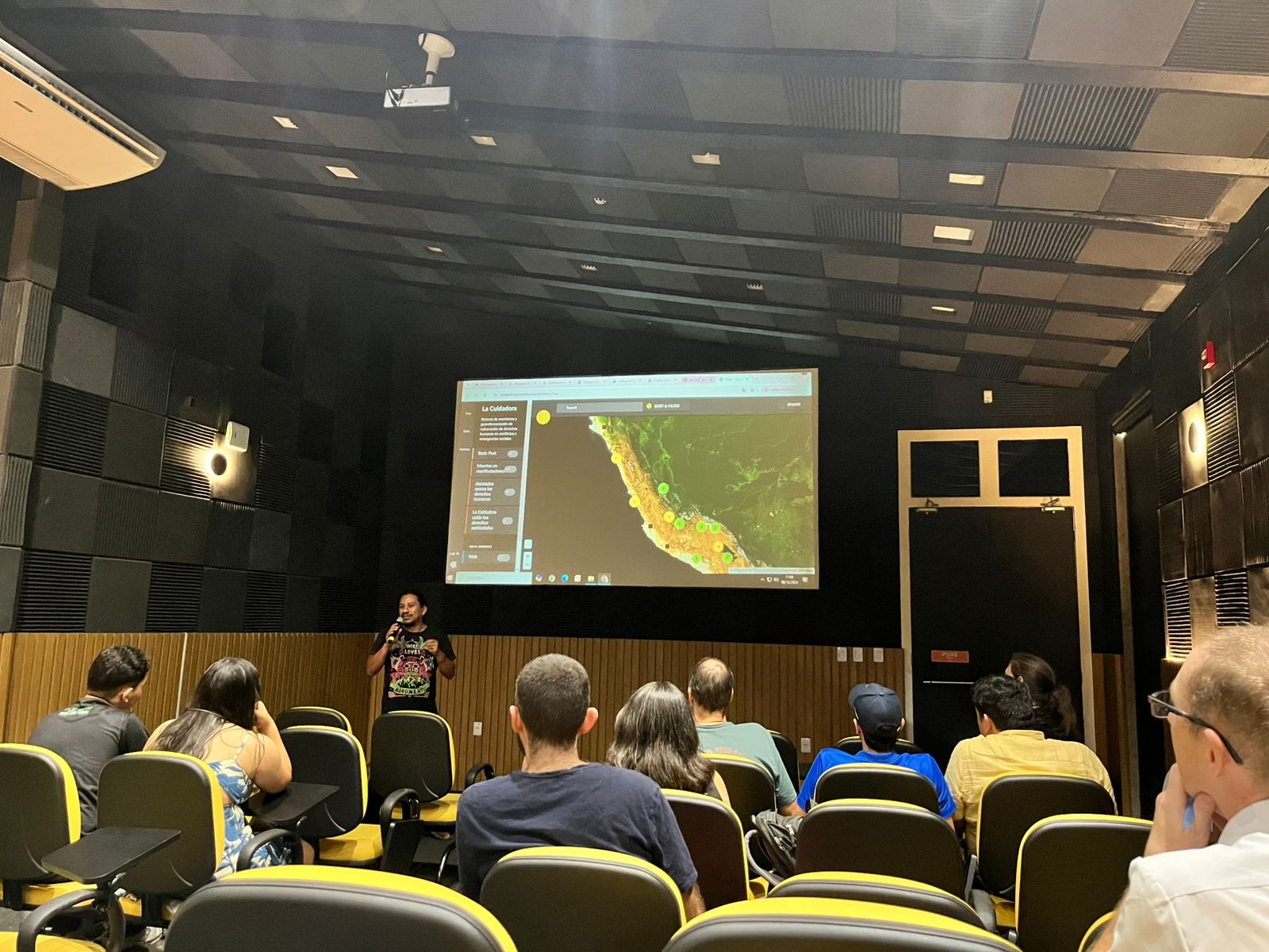
Juan Carlos Melo Luna brought to light the issue of Geographical invisibility of indigenous communities in the Colombian Amazon. With the support of the Humanitarian OpenStreetMap Team (HOT), a project was implemented to map territories using drones and collaborative cartography. Communities themselves took on the role of mappers after specific training, becoming protagonists in the construction of open data. The resulting maps were made available on public platforms, redistributing the power of spatial representation and ensuring that the needs of these regions were visible to external actors and policy makers.
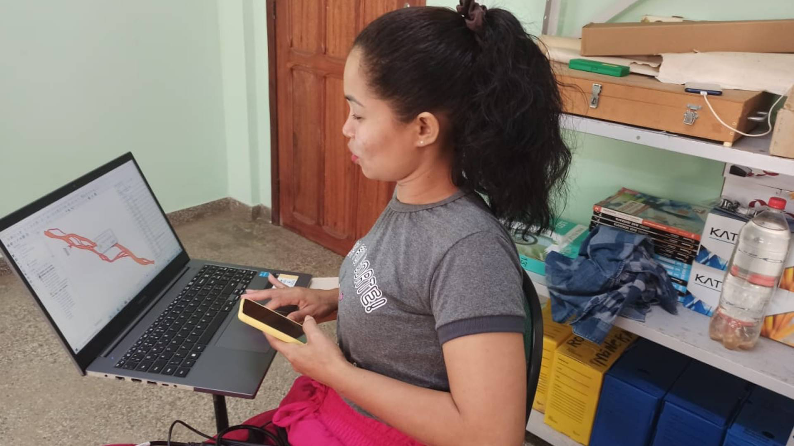
The impact of fallen lands (fluvial erosion common in the Solimões River region) was the topic of the presentation of Davy Rabelo. Using satellite images and drones, he told the story of Paula dos Santos Silva (foto abajo), with whom he mapped the affected areas in riverside communities in the Amazon, revealing the urgency of constant monitoring to avoid catastrophes. The work also highlighted the role of OpenStreetMap in disseminating essential data for public policy formulation.
On Ecuador, Iván Terceros reported on a series of workshops conducted by the Openlab Ecuador Foundation, in collaboration with local universities and municipal governments. Collaborative mapping training reached more than 250 people, promoting a culture of open data collection and use for risk management and regional development planning.
Open Technology Stories
The Geochicas collective, made up of feminists active in OpenStreetMap, seeks to reduce the gender gap and empower women in the world of free software and open data. Since 2016, the initiative has carried out projects such as mapping femicides, raising awareness of feminist mobilizations and technological training. Actions such as mapping streets with female names and campaigns against gender violence stand out.
Andrés Gómez Casanova presented tools to correct errors in the mapping of rivers and streams in OpenStreetMap. Using the waterwaymap.org system with layers published on the osm.lat geoserver, the solution identifies loops and incorrect endings, allowing the layout of water courses to be adjusted based on aerial images and official maps. The proposal aims to represent complete and realistic river basins, highlighting the importance of water preservation in Latin America.
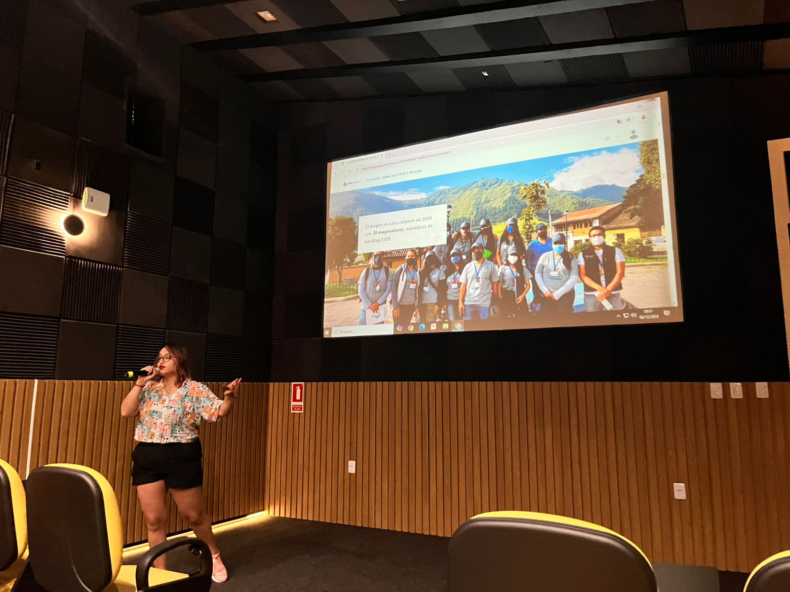
Carolina García Mancero highlighted a project that mapped vulnerable communities and evacuation routes in areas near volcanoes in Ecuador. Using tools such as OpenStreetMap and Mapillary, the project brought together a team in the field (see photo below) to collect critical data for risk management and strengthening local resilience, promoting collaboration between communities and organizations.
Séverin Ménard presented Panoramax, a community project to create a decentralized and accessible “Street View”. The workshop covered everything from image capture to publication and reuse, promoting the use of open standards and collaboration for their application in local contexts.
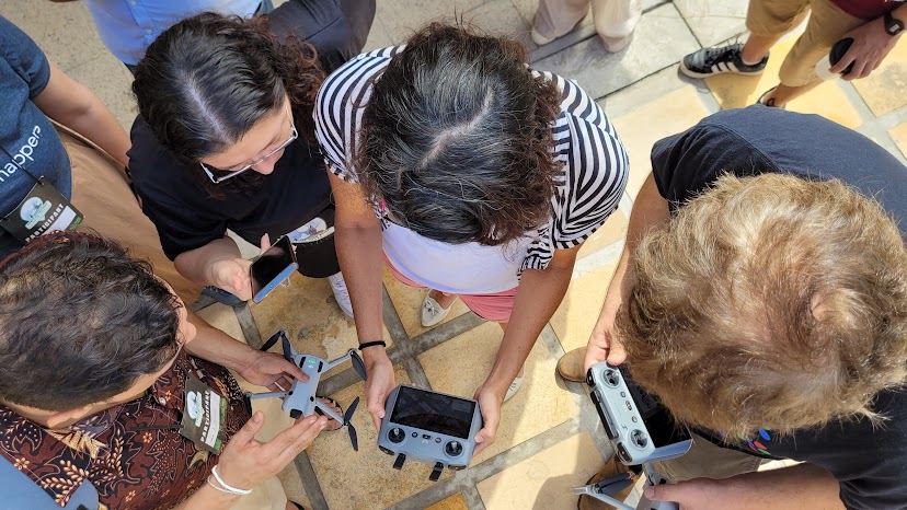
Emilio Mariscal and Ivan Gayton showed how the Humanitarian OpenStreetMap Team’s integrated open source tools enable end-to-end open humanitarian mapping. The workshop (pictured below) covered processes from drone image capture to field data collection and map export, reinforcing the impact of open technology on disasters and community action.
Stories of public space management
In Argentina, the agroecological movement has gained strength in recent years, especially in the Province of Buenos Aires, where the municipality of Luján has become a reference in mapping to mitigate disputes over land use. Andrés Esteban Duhour presented the case of the city, characterized by a transition scenario between the agricultural and urban areas, seeking to integrate agroecological practices in a context of strong pressure from conventional production models.
Yessica De los Ríos Olarte presented a participatory mapping project in Medellín, Colombia, to reduce community vulnerability to flooding. The collection of geospatial data included local infrastructure and risk factors, resulting in maps that guide mitigation and resilience measures. The initiative also promoted a culture of risk self-management.
The experience of mapping public transport has proven to be a crucial tool for improving urban mobility in Latin America, and this was the subject of the presentation by Leonardo Gutiérrez who has developed several projects for the Trufi Association, which operates in Mexico, Peru, Colombia and Bolivia. These projects often involve collaboration between local authorities and mapping communities, with the aim of generating accurate data on formal and informal transport routes. The use of tools such as OpenStreetMap and the JOSM editor has expanded as an effective solution for Latin American cities facing challenges related to the collection and organization of this data.
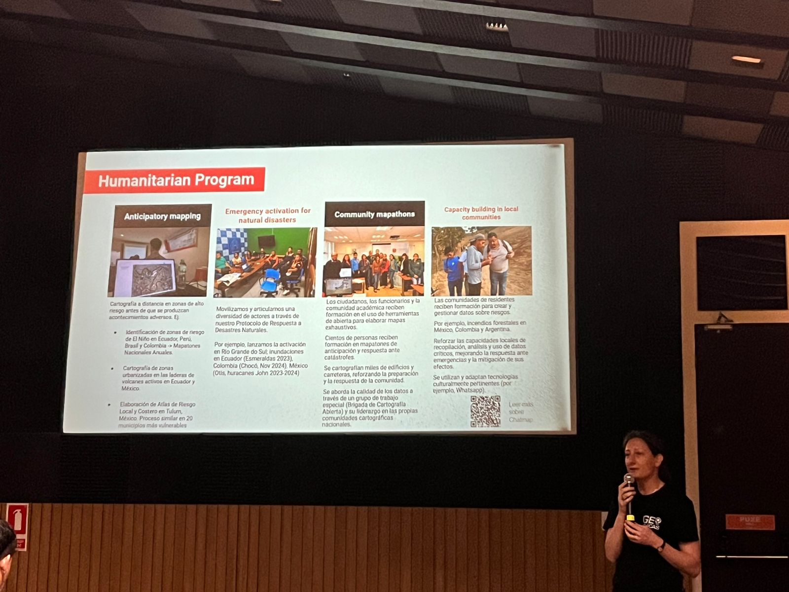
Céline Jacquin demonstrated how OpenStreetMap mapping has played an important role in the response to natural disasters in Latin America. The experience of the Humanitarian OpenStreetMap Team (HOT) in countries such as Peru, Ecuador, Mexico and Brazil shows how collaboration between governments, universities, organisations and communities has been vital in managing crises such as the El Niño and La Niña phenomena (see photo above). In emergency situations, the rapid creation of detailed maps has enabled a more efficient response, with up-to-date and easily accessible data. Training of local communities has also been a priority, promoting technical empowerment and helping to establish support networks on the ground.
Thinking about the world with maps
The State of the Map Latam 2024 was not just a technological meeting, but a demonstration of how the knowledge of hackers and makers can transform territories and lives.
Belém, with its unique geographical position and history of resistance, was the ideal setting to reaffirm that a fairer world requires local cartography that horizontalizes information on the map for everyone.
However, a map for everyone must also include other forms of life beyond cities, such as forests in all their layers: soil, vegetation, water, atmosphere.
The Earth as a public space must be the priority of every society, considered the first instance of public interest, where data arise and where all the historical struggles that transform the Earth into a territory shaped by the public opinion of each moment take place.
SOTM Latam, supported by organizations that believe in the usefulness of open maps, after all these presentations, opened up to a question on the eve of COP-30: how can we help save the planet “today” – and not “tomorrow”? By making maps that protect the planet?
Do you want to know more about how to get in touch with the OpenStreetMap Latam community? Join the community on the Telegram channel for initial or advanced questions. You can also watch the videos of this edition of SOTM Latam on the YouTube channel. See you on the map!
* Antonio Heleno Caldas Laranjeira is a journalist from the Federal University of Recôncavo da Bahia (UFRB), Master in Communication and Society from the Federal University of Sergipe (UFS), PhD candidate in Communication and Culture from the Federal University of Bahia (UFBA) and Professor of Geocommunications at the Brazilian University Institute for Research and Data Analysis (IPBAD).
from Humanitarian activities – Techyrack Hub https://ift.tt/fRHXyxh
via IFTTT


