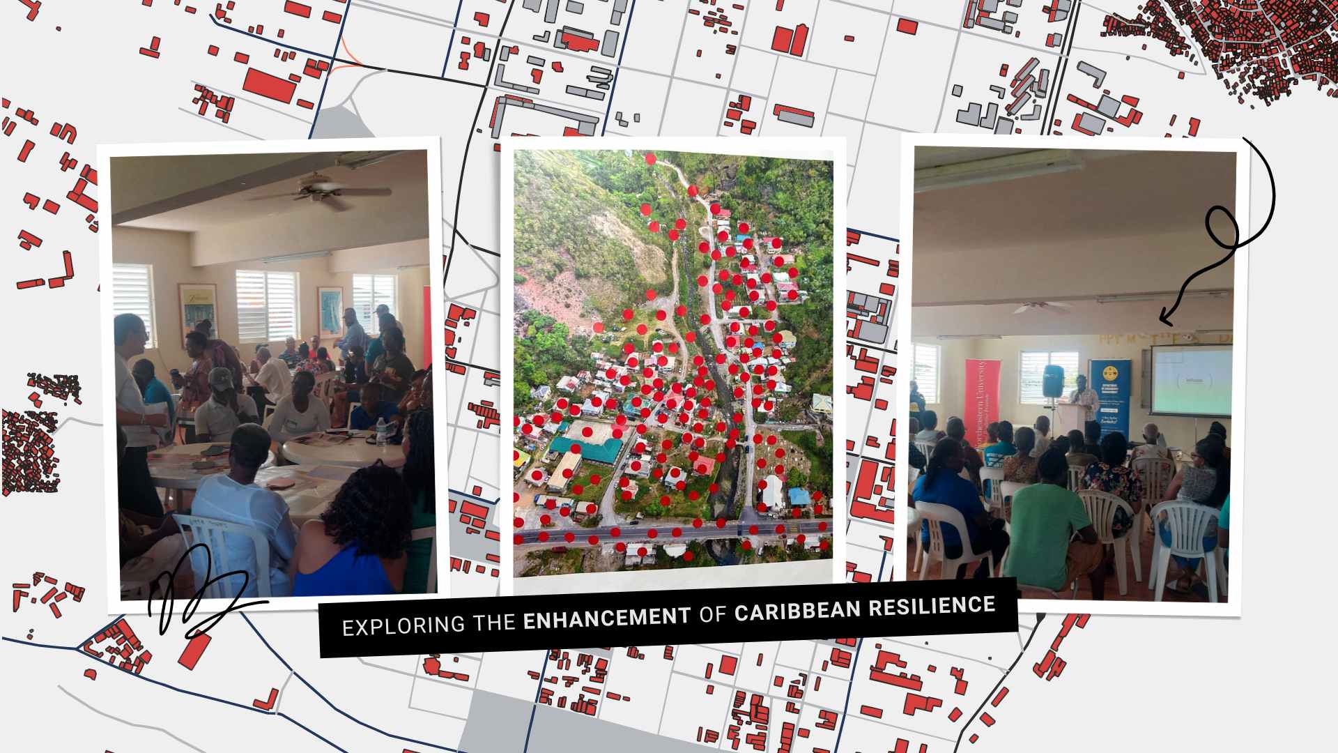
Discover how our collaboration with the University of the West Indies, University of Hawai’i at Mānoa, the Global Resilience Institute at Northeastern University, and the Caribbean Islands Higher Education Resilience Consortium is enhancing resilience planning in Coulibistrie, Dominica, through the use of drone imagery.
In June, the Northeastern team reached out to the Open Mapping Latin American and the Caribbean Hub (LAC Hub) for support in their “Advancing Community Climate Resilience Planning in the Caribbean Region” project. This collaborative effort, involving the University of the West Indies, University of Hawai’i at Mānoa, and the Global Resilience Institute at Northeastern University, along with the Caribbean Islands Higher Education Resilience Consortium (CIHERC), aims to enhance climate change mitigation and adaptation across Caribbean island nations.
HOT significantly contributed by supplying drone images of Coulibistrie, Dominica, essential for a community resilience workshop. Thanks to our work with the OpenCities Dominica project and OpenAerialMap’s crowdsourced imagery, we provided critical visual data. This initiative is key in why we are advancing the Drone Tasking Manager, enabling anyone with access to a drone, even an inexpensive consumer or DIY drone, to contribute easily and effectively to a global free and open aerial imagery repository.
We spoke with Dr. Stephen Flynn, Founding Director of the Global Resilience Institute at Northeastern University, to explore how HOT’s drone images are impacting their resilience efforts and to discuss future developments.
Coulibistrie, grappling with severe flooding from Tropical Storm Erika (2015), Hurricane Maria (2017), and another event in October 2022, faces ongoing challenges due to its geographic and climatic conditions. Vulnerable to river flooding, storm surges, rising sea levels, and landslides, Coulibistrie’s recovery from each disaster has been arduous, exacerbating community vulnerability.
In this context, the Northeastern team utilized HOT-provided drone images in a primary school exercise to visually illustrate and discuss community challenges. Stephen noted, “HOT’s contributions have been pivotal. The images provided were integral to our resilience workshop on June 29th and are now central to our planning with the Disaster Response Coordinating Committee.”
Check the OpenAerialMap of Coulibistrie, Dominica
During the workshop, 30 community members marked flood risk areas on maps with stickers, highlighting the river’s behavior and its impact. Stephen observed, “The exercise was an effective icebreaker, enhancing communication and learning between the community and the project team.” The imagery facilitated discussions, served as prompts to explain mapped points, and encouraged conversations about resilience.
In breakout sessions, the images sparked discussions on various aspects of resilience, including physical and natural risks, social vulnerability, economic factors, and governance. Visual aids helped participants recall and share insights, leading to a thorough exploration of each domain.
Key Insights and Applications from Coulibistrie’s Community Resilience Exercise

The project team engaged community council members early on, strengthening connections through partnerships with the Government of Dominica, including ODM, CREAD, and Local Government, as well as collaborating with UWI researchers and non-profits like the Red Cross and IsraAid. This collaboration led to the creation of the Community and Climate Resilience Alliance (CCRA), focused on supporting Coulibistrie’s resilience goals.
The recent workshop, featuring 30 participants, the Coulibistrie Disaster Response Committee, and the Red Cross, indicates growing community involvement and interest in future capacity-building sessions.
The Northeastern team is developing a Story Map to capture community stories, utilizing LAC Hub imagery. Breakout sessions have deepened understanding of community needs.
Next steps include collecting additional insights, photos, and videos to enrich the Story Map. Continued engagement with the community will ensure transparency and active collaboration.
A landscape analysis is underway to assess local initiatives, helping to formalize a climate alliance with ministries and NGOs in Dominica, guiding strategies specific to Coulibistrie’s needs.
What’s Next
.jpg)
The Northeastern and HOT teams anticipate ongoing collaboration beyond the pilot phase, recognizing its foundational role in developing strategies with Caribbean communities. Future efforts include incorporating indigenous knowledge and ensuring substantial impact.
The team plans to involve high school students in local projects, using imagery relevant to their contexts. In Barbados, they will focus on capturing high-resolution images to enhance their initiatives.
Northeastern’s future plans involve expanding USAID initiatives to other Eastern Caribbean islands. This includes replicating exercises like the red dot map activity in Coulibistrie, Dominica, and Barbados, incorporating images from Pile Bay and Crab Hill into the Story Map project.
HOT has obtained the images for the Barbados exercise, where Arnelle Isaac, our Disaster Services and Climate Resilience Specialist, participated as an observer. The meeting and community engagements allowed stakeholders from across the region to share ideas on Climate Resilience throughout the region and to also observe the process and think of ways the project methodology can be adopted in different islands.
This collaboration aims not only to strengthen HOT’s partnership with the project team but also to enhance visibility and highlight the significance of community-based mapping exercises. Engaging with various organizations and other project stakeholders in Barbados provided an excellent opportunity to boost HOT’s presence in the region.
from Humanitarian activities – My Blog https://ift.tt/5J2DczR
via IFTTT


